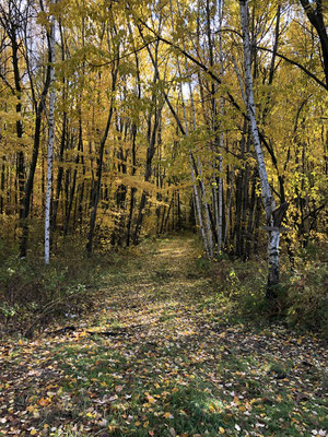
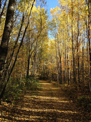
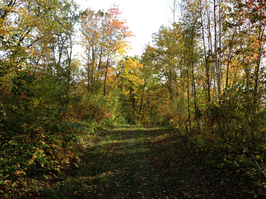
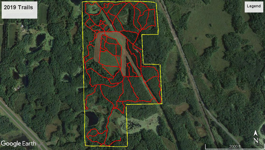
The Trails
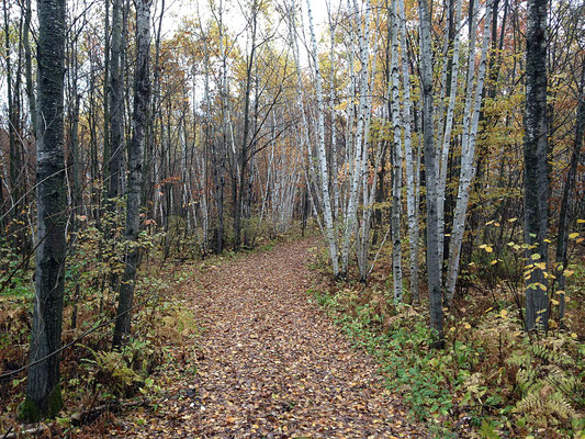
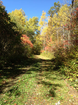
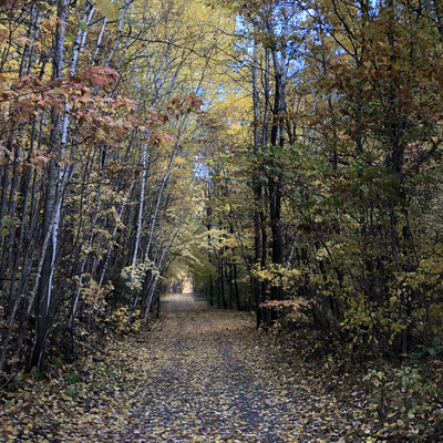
To provide maximum utilization of the property, an extensive network of trails was required. Without, how the property was planned to be used and currently is could and would not occur. The trails are for hunting, management activities, possible fire control and other recreational activities. Prior to creating the trails, a complete survey was required. All the trails run the perimeter of the property, yet always be on the property so they remain private. Within weeks of the purchase, a registered survey was completed and recorded with the county. Accompanying the surveyors, I marked the boundaries as the surveyors ran the lines and pinned the corners. Most land with water features have areas which are inaccessible. This prime parcel does not! Every square inch of land on this property is useable and one of the elements that make this large of parcel so unique for Minnesota.
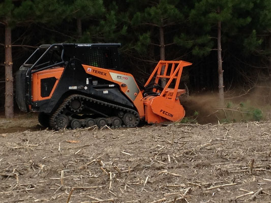
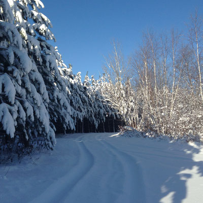
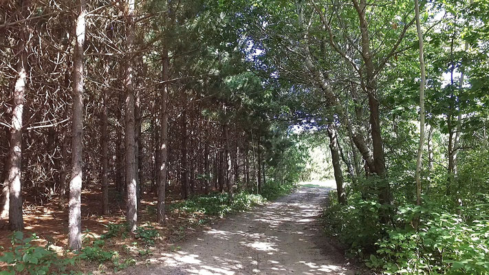
When we purchased the land there was about a two miles of old logging trails. Immediately upon completion of the survey, repair of the old and construction of new trails began. Utilizing a mulching machine, the trails that had been painstakingly planned were started. Being conducted in January, progress was slow. Only 1 1/2 miles were completed before a snowstorm forced a withdrawal of the equipment until Spring. However, by the end of the summer almost 7 miles of trails were constructed. Over the next couple years more trails were added. Today, after the 2018 logging, the trail system is over 9 miles long. They are all maintained year around keeping the pathway clear for the varied uses.
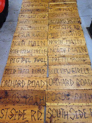
There were so many trails it became apparent they needed names. So, in 2013 over 100 cedar road signs were made to prevent people from becoming lost while using the trails. With all the trails having names, it also made hunting safer as people could accurately describe where they were going. Now in 2022, we have upgraded to 109 commercial grade aluminum road signs with highly reflective letters that should last for 25 years plus.
Our four grandchildren have a road named after them; Reagans Run, Holly Hill, Aria Way, and Avery Ave. Below is a map and complete list of the trails.
- Camp Road
- North Main
- Northeast Loop
- Hungry Beaver Trail
- Deer Trail
- Nightmare Hill
- Pretty Pond
- North Field 1
- Northwest Loop
- North Aspen Road
- South Aspen Road
- Grouse Road
- Tapping Lane
- Lauries Lane
- Ravine Road
- Snipers Hill Way
- Four Bear Path
- Orchard Road
- West Side Road
- Short Cut
- Cross Over
- Buck View Circle
- Avery Ave
- Aria Way
- Dad's Walk
- Plantation Road
- East Side Road
- Maple Way
- Beaver View
- Murphy Lane
- Maple Valley
- Maple Heights
- Jim's Trail
- South Main
- Pogo's Path
- Reagans Run
- Red Pine Circle
- Gun Range Road
- Twin Lake Trail
- South Side Road
- Doe Road
- Turkey Trail
- Blind Bear Trail
- Holly Hill Road
- PR Lane